Cheadle Hulme |
. | . | History - ad 1930-1999 |
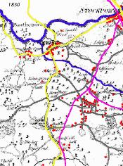
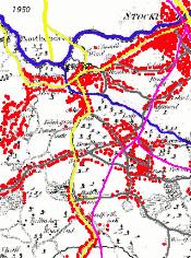
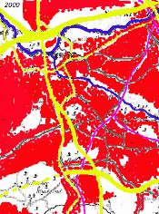
Urbanisation
|
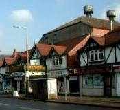
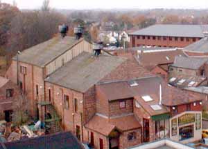
Housing & Amenities A cinema
(originally on Mellor road), was opened on November 11th 1930 as the Elysian
Cinema on Station Road just after the talkies appeared. This closed on March 2nd
1974 and the building was used for a time as a supermarket (Kwik Save) and then became a
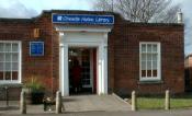
posh shopping mall (more). A new library
was opened in 1936 following on from 7 years of 'free' library services
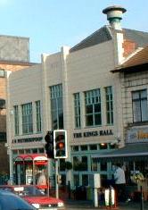
in Mellor Road. Kings
Hall also on station Road was built in 1937 and used for dances,
whist drives, meetings, and wedding breakfasts. In the 1970s it became a restaurant and
was internally refurbished in the late 1990s as a pub (Witherspoons). Second World War
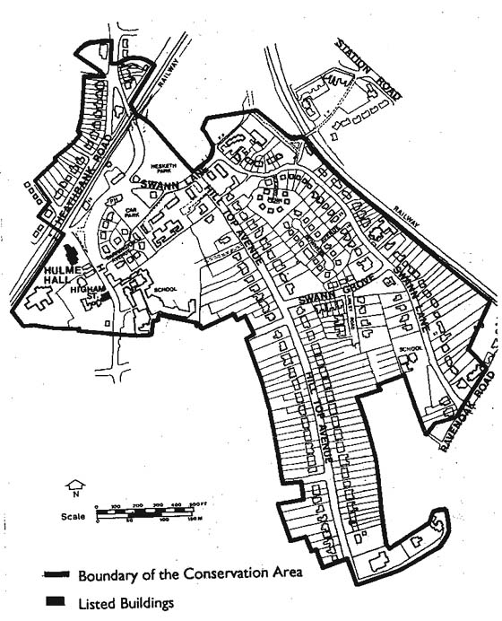
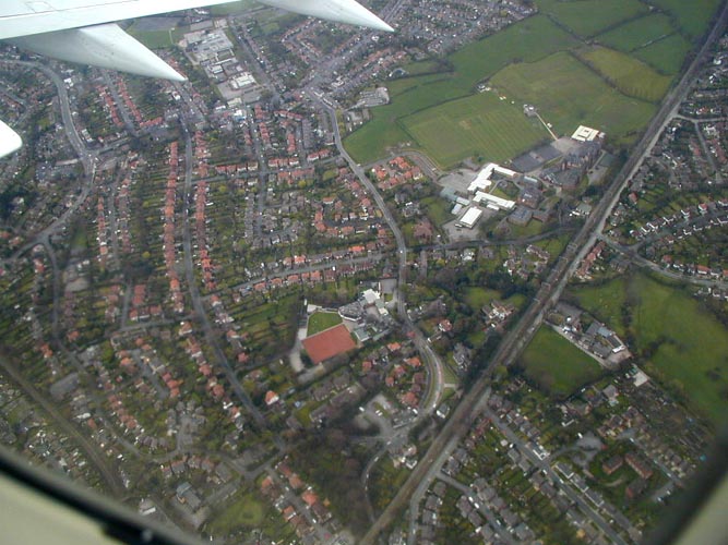
Years Stockport was bombed in 1940 and 1941 (2 people were killed in Cheadle). German bomber was shot down & crew bailed out over the Cheadle Hulme area and taken prisoner. Some of the fishing ponds close to the new Handforth Dean shopping area are reported to be bomb craters. A number of V1 rockets also hit the area in 1944. Postwar housing boom In the 1970s more houses were built, this time closer to the station area at Ramillies avenue - the Marlborough estate. Since then there has been much filling in of the remaining spaces by individual houses or small developments. Social changes in the last 30 years of the century saw a major decline in cinema- going as home television took over. Drink-driving laws, increased wine consumption and dinner parties also contributed to a decline in the traditional pub - thus many were modified for family and dining use. As rapid changes occurred there was also increased interest in local history and heritage - hence this web site! A conservation area was also established to preserve some of the character of Cheadle Hulme (See also Aerial View 2000). |
Transport
Air travel increased greatly in the 1970s and 1980s (and for the Cheadle Hulme area brought increased jobs, traffic, and noise). In the 1990s a new air terminal and rail station was added and construction of a second runway begun (1998 - due for completion in 2000). Some specific changes
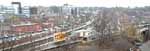
in the area include:- 1956 - Etchells Road created 1958 - The Conway public house opened on Turves Road. 1959 - Kingsway (Road) extended south across the Mersey, thus bypassing Cheadle. 1960s - Street lamps converted to fluorescent lighting. 1960 - Cheadle Hulme Fire Station opened on Etchells Road 1964 (May 28th) train
derailment at Cheadle Hulme centre's bridges killed 3 people and resulted in extensive
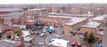
rebuilding 1967 - Station Road was widened and straightened to pass directly in front of Millington Hall instead of joining Bellfield Avenue. This lead also to office block development and increased traffic - 'the end of the village atmosphere' said many. (More). 1970 - A smithy in Hulme Hall Road used for shoing horses was designated to be replaced by a public house called the Smithy. Instead the Smithy pub was built on Stanley road and the smithy site became the Smithy Green doctors surgery. Later (1985) part of this moved to Bridge House on Ladybrook Road. 1970s - Three motorways were built in the borough (M63, M56, M62) and in 1974 the M63-M62 (spaghetti) junction at Kingsway was constructed. 1974 - Cheadle High Street takes 24,000 vehicles per day! 1980s - M63 motorway extended through Stockport. 1980s - There were still two large pockets of open land between the Woking Road estate and Kingsway albeit bisected by the railway (an area Fletcher Moss tried to preserve in 1894), and south of Stanley Road and Grove Lane. 1990s - Kingsway (A34) was extended to bypass Cheadle Hulme, Handforth and Wilmslow (1997), and the MAELR route was built from Woodford to the old A34 at the Waggon and Horses Inn effectively disturbing the above two remaining spots of tranquility. The new roads (like the railways of the past) brought two massive 'out of town' shopping developments and two new names to the area - Cheadle Royal (included the Lewis's, Sainsburys, and Lloyd Centre) and Handforth Dean (Marks & Spencers, Tescos, Allders).
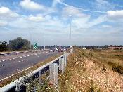
Cheadle Hulme Bypass
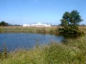
New Leisure Centre
Many other aspects (schools, pubs, clubs, etc) of Cheadle Hulmes's recent history are covered in Topics.
|
UDC & Surrounding areas 1939 - Mersey covered in Stockport centre by a concrete plinthed road. 1960s - Stockport's shopping facilities (Merseyway Shopping Precinct) expanded over the covered Mersey. 1967 - Passenger aeroplane crashed in Stockport centre In a foreword to Tom Bowden's book on Cheadle & Gatley UDC (1974) Lord Redcliffe-Maud summarises nearly a century of achievement for the UDC - "They have been pioneers and path-finders for a century. I know of no other town in Britain with a finer tale of democratic innovation. Telephones and library service available before the nineteenth century ended; housing and town-planning underway before the first World War; electricity by 1924; imaginative help for the unemployed during the 'thirties'; a green belt before such things were nationally heard of; leadership in smoke-control and use of the computer ...." 1974 (April 1st) Stockport Metropolitan Borough created (included Cheadle, Gatley, Cheadle Hulme, Bramhall, Hazel Grove). This became one tenth of the new Greater Manchester County. (The GMC council was abolished 1986 but the area county is still extant). Most Cheadle Hulmites never ceased using Cheshire as the postal address anyway!
Epilogue from
MM
|
| Also see Squire 1994 |

