Cheadle Hulme

. .

History - Overview


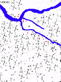
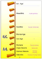
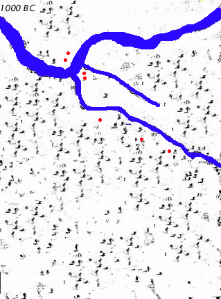
3 Millennia of Land Use in the Cheadle Hulme Area

Blue - rivers, Red - houses, Yellow/Grey - roads, Purple - railways

[Click HERE for larger (220k) Animation]

Timeline

Timeline - Eons

Hulme Hall in 1999
Hulme Hall

Features
Whilst modern Cheadle Hulme at first seems an overpopulated, totally built up, traffic congested, noisy, busy commuter town - closer investigation reveals a pleasant area with decent housing, schools, shops and good employment and educational opportunities - and an ample supply of parks, amenities, and heritage (Hulme Hall, Millington Hall, Cheadle Hulme School and nearby Bramall Hall and Cheadle Church). It is also conveniently situated for road, rail and air access - both in and out!

Its history involves also the histories of Cheshire, Stockport, Manchester, and the political, industrial and technological changes in  England and the United Kingdom.
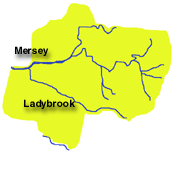
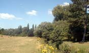
Untouched fields at southern tip of Cheadle Hulme - 1999
Remaining Building Land ??

Landscape
Cheadle Hulme lies in the extreme western area of Stockport Borough on the low, fertile Cheshire Plain about 5 miles from the Pennine foothills. It lies along one of the Mersey tributaries the Lady Brook (Micker Brook) which also runs through the neighbouring villages of Bramhall and Cheadle.

Rivers  (N^)

Ladybrook Valley looking North towards Seven Arches
Ladybrook Valley - Cheadle Hulme

Much of the land changed in prehistoric times from barren tundra to peat bogs and mosses, to open farmland, and in the second millennium to cultivated farmland, to isolated cornmills, to home textile production, and finally to housing, light industry and shopping areas. The lack of mining, raw materials, or powerful rivers have kept the place green, pleasant and peaceful for a long time until it eventually succumbed to human commuters.


Population
From migrating hunter- gatherers of the Mesolithic period, to settled early farmers in the Stone and Bronze Ages and passing Romans in the first millennium AD the area was basically rural and sparsely populated. Anglo-Saxon, Medieval communities and Manors and the Industrial revolution did little to change the area save for a few minor roads and tracks leading to farms, and a few name changes. The railways and new roads from the 1840s to 1990s brought an

Railways (Click for more details)

increased population and produced the rural village community which then changed almost beyond recognition, becoming overridden due to mass house and road building during the last 50 years to accommodate the expanding populations of Stockport and Manchester.

Marks & Spencers shopping, and car parks -1999

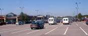
Handforth Dean Shopping

. Future!
Will Cheadle Hulme keep expanding across the 'green belt' and fuse with other communities to the south and west?
Future!
Will major sporting and leisure developments consume it?
Future!
Will the internet and other modern technologies relieve its roads and travellers?

MM