| . | . | Topics |
|
This page |
Public Houses
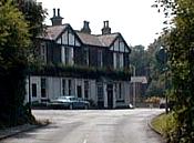
Church Inn - formerly
Knapsack Inn near Pump farm. The 1st landlord was John Brown ('The Nap'), then generations
of Turners, and later the Bromleys who also owned Ravenoak Hall/Oakley Manor just across
the road. Now a Robinson's house. Oakley Manor was originally called Ravenoak (1882) and catered for English style evening meals to live piano accompaniment, receptions, and accommodation. It was rebuilt in 1998 and became the Governor's House. The Cheadle Hulme (Station Road) was called 'The Junction'. The Conway (Turves road) opened 4th December 1958. Cross Keys - Adswood Road. Micker Brook (Councillor Lane) - built in the 1990s. Old Mill (off Ladybridge Road) - was Adswood Mill (a cornmill), lying immediately adjacent to the Ladybrook. Refurbished in the 1980s and again in the late 1990s.
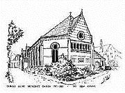
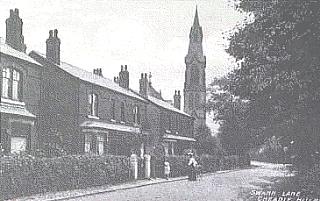
Smithy - built 1970 on Stanley Road/Gillbent Road junction. This was so called because it was originally to be built at Smithy Green where the Health Centre is now. Kenilworth - built in the1930s on Cheadle Road and extended and modified in 1995. Churches All Saints Church was built in1863 as the Cheadle Hulme parish church. It was extended in 1877 and had a spire which later collapsed. (see Maps & Pictures). Congregational Church - built with a tall spire in 1870 on Swann Lane opposite Oak Farm. It burned down in 1977 (amid local arson attacks). It is now replaced by the United Reform Church (1979). Methodist Church -
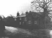
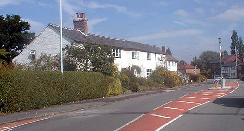
The current church was opened in1968 off the newly widened Station Road and Ramillies Avenue. (See Lee, 1967). St Andrews Mission Church - built in 1938 on Cheadle Road to minister to the northern part of the continually expanding parish. St Anne's RC - (1952) on Vicarage Avenue. Mass was held in the Kings Hall during the second world war years. St Columba's Presbyterian Church - on the junction of Stanley Road and Kingsway (1968-9). Christian Science Reading Rooms (Society of Friends) - Albert Road /Queens Road. Farms Higher Bent Farm (1768)- At the southern end of Gillbent Road on the bend facing the shops. Became part of the 1960s housing estates. Lower Bent Farm - Gillbent/Grove Lane, belonged to the Leather family. Still extant and surrounded by school buses. Lane End Farm in the centre of Cheadle Hulme and one of the oldest finally disappeared in 1967 under the Station Road widening scheme but its name is perpetuated in Lane End Primary School. Also demolished were Station Farm and Homestead Farm for the Methodist Church. There is some query as to a Davenports farm in this central area. Stringers Farm (?1780s, definitely present in the1860s) on Gillbent Road close to the Thorn Grove School area. Pinfold Farm - off Cheadle Road/Hulme Hall Road (in use as a farm1850-1930). Now a housing area. See Smithy and Henshaw/Browns Orrishmere Farm - on the boundary of Cheadle and Cheadle Hulme on Cheadle Road - now a golf course and houses. Ladybridge (Leathers) Farm (1764) - off the avenue now known as Ladybridge Road close to the seven arches and Old Mill. Still extant with its stables and horses, Jimbob pulled the milkfloat until 1985.
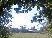
Windy Arbour Farm - gave rise to the Bruntwood Stud and later Bruntwood park Other farms which have disappeared or given rise to local names include Bird Hall, Oak farm (near the Griffin Inn), Brookside, High Grove, Lum, Pymgate, and Outwood. Houses |
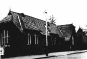
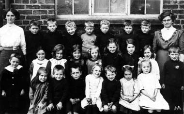
Schools National School (built
1873, demolished 1973). In1974 a new Church Hall (to complement the Parish Hall, opposite,
built in 1910) was built on its site. Now the Newsagents 'Busy Bee' carpark and the
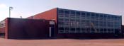
opening to Hill Top Avenue (1906) covers its site. Woods Lane School (1935) built as a secondary modern school. In 1972 became Cheadle Hulme County High School, 1974 Cheadle Hulme High School, 1996 Cheadle Hulme College.
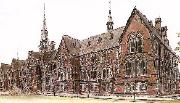
Warehousemen & Clerk's Orphan School (1869, costing �15,000) now a top-class private school called Cheadle Hulme School.
Hulme Hall School (Hulme Hall Road) the Swann Lane part of this school was closed in 1998. Royal Schools for the Deaf - opened in 1956 on an 80 acre site off Stanley Green. Grove Lane Baptist Day & Sunday
School (1846).
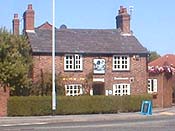
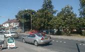
Roads Station Road was Mayfield Grove and Lane End and previously Cheadle Hulme Common Road. From a quiet country lane it passed narrowly under two railway bridges in the 1840s and was eventually 'improved' in the 1960s. Road Improvement Stanley Road and Grove Lane was Rogues Lane (1844) and joined Long Lane (A34) at the Waggon & Horses pub - previously Stanley House. Ramillies Avenue was Cow Lane. Church Road was Church Lane.
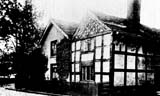
Ravenoak Road was Ravenoak Lane, formerly Pump Lane (1890s). Although widened and tarmaced in 1934, the weavers cottages still remain. Turves Road was Turf Lane. Ack Lane was Hack lane (after Hacon the Saxon). Higham Street - still is Higham Street and was the birthplace of Reverend Joshua Brookes of 'Manchester Man' fame. Miscellaneous
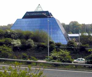
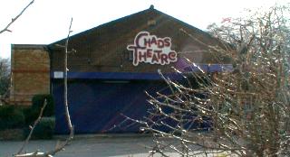
Dr Edmonson's House - (1930s-1962) demolished for the new shopping precinct. Stanley Green Estate was the land belonging to Stanley hall which was sold by the Quakers in 1922 and is now an industrial estate. Although the hall still stands. CHADS (Cheadle Hulme Amateur Dramatic Society) was founded in 1921. A new brick built theatre was opened in1959 on the present site. Plays are regularly performed there and are well attended. Cheadle Hulme Cricket Club - (founded 1881), entered the Cheshire County league in 1975. Originally located next to Ladybridge (Leathers) Farm in 1939 the building burned down in 1946. Manchester Rugby Football Club moved from Salford to Cheadle Hulme in 1967 and shares facilities with the local Cricket Club. Rugby sevens is a popular event held each summer. (see Directory) Recreation grounds & Parks - Heathbank Road, Maple Avenue, Woods Lane, Grove Lane Park, Carrs Road, Bruntwood Park (golf & play area expanded in 1971). Swimming Pools in Cheadle (1974), Sports Hall at Woods Lane for squash, badminton, 5-a-side (1974). Ambulance Station at Turves Road alongside fire station on site of old brickworks. Banks (6 in 1973 on Station Road and Church Road, only 1 in 1999 - although a number of building societies took over this role). Citizens Advice Bureau - Station Road Post Offices are available at Warren Street (sorting office), Cheadle Road, Mellor Road and Gillbent Road. Police Station - built in 1912 on the corner of Station Road and Ravenoak Road. This was still used as a jail in 1998 but is now largely unmanned as a call station. Hospitals - Cheadle Royal Hospital was founded in 1766 (in Manchester) as a Lunatic Hospital. In 1848 it moved to its present site (part of Finney Farm in Long Lane) and became the Cheadle Royal Lunatic retaining close association with the Manchester Royal Infirmary. St Anne's a neighbouring hospital for epileptic children was bought by Cheadle Royal in 1887 and later became St Anne's Hospice. Barnes Convalescents Home was opened in 1875 in Cheadle. The local area is served mainly by Stepping Hill Hospital in Stockport. Office development - this expanded rapidly in 1965 and the AA, TGWU, Bull, CEG set up large offices. A number moved out in the 1990s leaving a lot of empty office space rather than green space in the 'village'. |
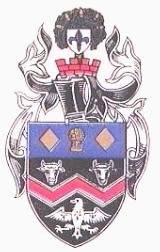
Coat of Arms
The red central W is from the arms of the de Chedle family, the wheatsheaf refers to the Earls of Chester and to Cheshire sitting between two gold lozenges from the arms of the Stopford or Stokeport family. The field of blue represents Stockport Etchells. The white bulls head represents the Bukeley family, and the ermine eagle crest the Moseleys. On the top is the oak tree of the area and five golden acorns signifying Cheadle, Cheadle Hulme, Gatley, Heald Green, and Adswood. The outer fleur-de-lys signifies St Mary's Parish.
Population Graphs Ch Moseley Ch Bulkeley 1831 Cheadle Hulme & Adswood = 617 Census Data (1851) Cheadle & Gatley Cheadle
Hulme Census
People in the
1800 & 1900s John Burrows in the 1830s, and 1850s was a manufacturer of textiles. Fletcher Moss (1894) comments extensively on the local folk, their backgrounds (especially comparing the sturdy farming stock to the puny town dwellers), and also mentions the presence of a few immigrants, especially Jews and Germans. He also remarks on the local asylum inhabitants. Not a lot has changed during the mass influx of the past century and most of the population are still white 'anglo-saxon'. Only very recently (1990s) the boom in 'foreign' and take-way food has seen a small influx of eastern ethnic minorities, especially as shop-keepers. Also, of course the asylum inhabitants are no longer in asylums! Stockport
|
| . |